Printing Maps and Chart Lines

Contents
It is possible to print the currently displayed map (and chart, stars, eclipse and track lines) onto a graphics capable printer which is installed in Windows. If you have a color printer, then the map lines, chart lines and eclipse lines can be printed in color. Note, however, that most printers do not have the capability of printing land and sea fill colors, so no land, sea or special fill colors will normally be printed, with the exception of the day/night shading area, if this option is switched on. (See Color and Font Settings for more information on setting printer color options.)
Before you print for the first time, you should ensure that your printer is connected and working, and loaded with paper. You can do this by using another Windows application such as a word processor, and printing a small sample of text. If this is successful, then you are ready to try printing from Solar Maps.
>> |
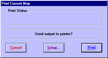
To print the currently displayed map and chart lines |
Select “Print...“ from the “Chart“ menu.
This will display the “Print Current Map” dialog box
>> |
To alter your printer settings (eg. change the printer resolution) |
Click on the “Setup...“ button.
See your Windows manual or your printer’s manual for further explanation on printer setup options. Typically this option is used to ensure that you have selected the correct page size for your paper, the appropriate print resolution (ie. print quality), and any other options that your printer may allow you to choose.
>> |
To start printing |
Click on the “Print“ button.
This will send the printout to your printer. If you have disabled your print manager, then the printer should start printing almost immediately. However, if the print manager is enabled (as is usually the case), then the printout is sent to the Windows print spool file first, and the printer will not start printing until the whole printout file has been sent.
If your printer is offline or otherwise unable to print, then Windows will normally issue a message to tell you this, and ask you to either correct the problem or to cancel the printout.
Note: Solar Maps always prints maps in landscape (sideways) orientation, regardless of which orientation you choose in the printer setup. This is done to ensure that the printed map retains a similar height/width ratio to the screen.