Selecting Zodiac Projection Type

Contents
When drawing astrological chart lines onto a map, it is possible to project the zodiac onto the Earth’s surface in either of two different ways. These are
• |
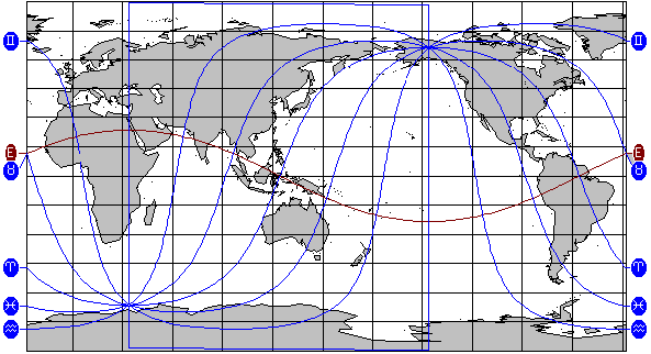
Celestial - This projects the true positions of the zodiacal signs, ecliptic, and planets onto the Earth’s surface, as they would be seen in real life. This is the projection method that is normally used in standard astro-locality mapping. |
• |
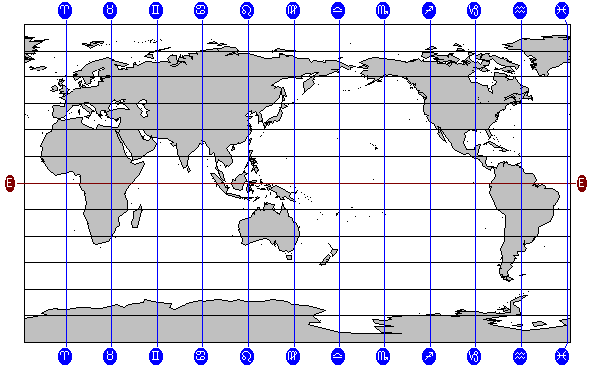
Geodetic - This projects the ecliptic onto the equator, so that the zodiacal signs then correspond to bands of longitude around the Earth. Typically the 0Âş Aries point is projected onto the Greenwich meridian (0Âş of longitude), and the sign divisions falls every 30Âş around the equator, eastwards. This projection method is often used in mundane astrology (the astrology of national and international politics and events). Solar Maps enables you to select a different terrestrial starting longitude for the 0Âş Aries point, if you wish, and also to specify the direction. The starting longitude option may be used to define the zodiacal starting point at the longitude of the great pyramid in Egypt, for example. |
When the geodetic projection is in use, Solar Maps includes the caption “(Geodetic)” after the chart name on the title bar of the window. If this is not present on the title bar, then the normal celestial projection is being used.
Celestial Zodiac Projection
Geodetic Zodiac Projection
You can switch to either zodiacal mapping option by selecting it from the menu.
>> |
To switch to the celestial projection method |
Select the “Celestial“ option from the “Zodiac“ item under the “Chart“ menu.
>> |
To switch to the geodetic projection method |
Select the “Geodetic“ option from the “Zodiac“ item under the “Chart“ menu.
In both cases the chart will then be redrawn using the selected projection method.
>> |
To select the geodetic zodiac options |
Select the “Geodetic Zodiac…“ item under the “Options“ menu.
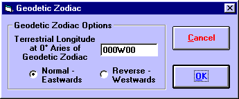
In this dialog you can enter a starting terrestrial longitude, and choose to map the zodiac either eastwards or westwards. The options you choose here are remembered when you re-start the program and remain in effect until you next alter them.